21 Must-Do Hikes in Shenandoah National Park’s Central District
Shenandoah National Park’s Central District runs from the Thornton Gap entrance (milepost 31.5) to the Swift Run Gap entrance (milepost 65.7).
This section of the park is home to lots of fantastic hikes, from fully-accessible trails like the Limberlost Trail to popular waterfall hikes like Dark Hollow Falls.
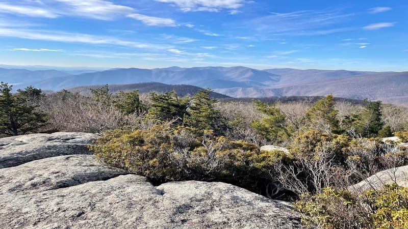
The Central District is also home to both park lodges, Skyland and Big Meadows Lodge, as well as the park’s two sit-down restaurants and four picnic areas.
Central District Hikes
Here are 21 fantastic hikes to add to your list of hikes to check off at this scenic and historic national park. I’ll keep my eyes open for you on the hiking trails.
#1: Mary’s Rock (mileposts 31.6, 33.5)
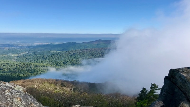
Whether you approach Mary’s Rock from the northbound or southbound trail, get ready to be bowled over by the spectacular views across the Shenandoah Valley.
Hiking north, park at the Meadow Spring parking area at milepost 33.5. The leafy trail wows with the remains of an old stone chimney and a glistening stream.
Both routes to the top of this massive (and massively popular) rock are less than 3.5 miles. At the top, savor the outstanding panoramas across the valley.
#2: Little Stony Man & Stony Man (milepost 39.1)
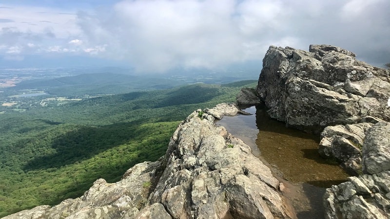
While scenic views abound across Shenandoah National Park, it’s hard to beat the two-for-one deal you get on this 3-mile out-and-back hike.
Within the first mile, you’ll climb 190 feet to reach Little Stony Man Cliffs. It’s hard not to be awe-struck by the sweeping views from the rocky outcrops.
At Stony Man Summit, you’ll encounter more scenic vistas. The rocky outcrops are not challenging to navigate, but watch your step and stay fleet of feet.
#3: Passamaquoddy Loop (milepost 41.7)
The 2.5-mile Passamaquoddy Loop hike is quite popular as far as I can tell, garnering more than 130 reviews on AllTrails.com and an average rating of 4.5.
Start at the Stony Man parking area and go clockwise on this forested loop, if only because the connections between trail segments are more obvious clockwise.
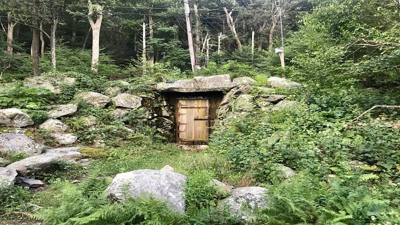
Keep your eyes open for a hobbit door mid-hike. More likely it’s for the electrical technicians given there are power lines above, but it looks like a hobbit door.
#4: Millers Head Trail (milepost 42.5)
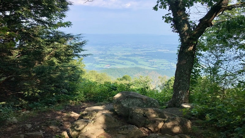
The 1.5-mile out-and-back hike on the Millers Head Trail at Shenandoah National Park guides hikers to a former fire tower that dates back to the 1940s.
At that time, there were seven fire towers in this national park, each manned around the clock. However, you can savor big views well before the fire tower.
At the .2-mile mark, you’ll reach a short spur trail to Bushy Top Observation Point for scenic views of Massanutten Mountain and working farms down below.
#5: Limberlost Trail (milepost 43)
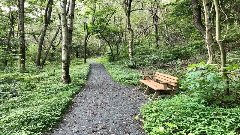
The fully-accessible Limberlost Trail is located within Shenandoah National Park at milepost 43. This 1.3-mile loop is one of the most-trafficked easy hikes in the park.
This mostly flat, crushed greenstone walkway is stroller-friendly and wheelchair-accessible. With the exception of service animals, this trail does not allow pets.
More than 15 wooden benches dot the Limberlost Trail. Cross over a few bridges and boardwalk sections. At the .8-mile mark, you’ll see a columnar jointing.
#6: Crescent Rock (milepost 43)
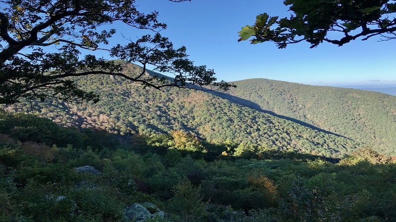
The 3.3-mile out-and-back Crescent Rock hike at Shenandoah National Park is an easy one, leading hikers to views of Massanutten Mountain and the Ida Valley.
At the overlook, a placard relays the history of families that remained on the land after the national park was officially established in late-1935.
Interestingly, the Crescent Rock Overlook can be reached on foot by way of this hike or by car. Simply park in the sizeable parking lot at milepost 44.
#7: Hawksbill Summit (mileposts 45.5, 46.7)
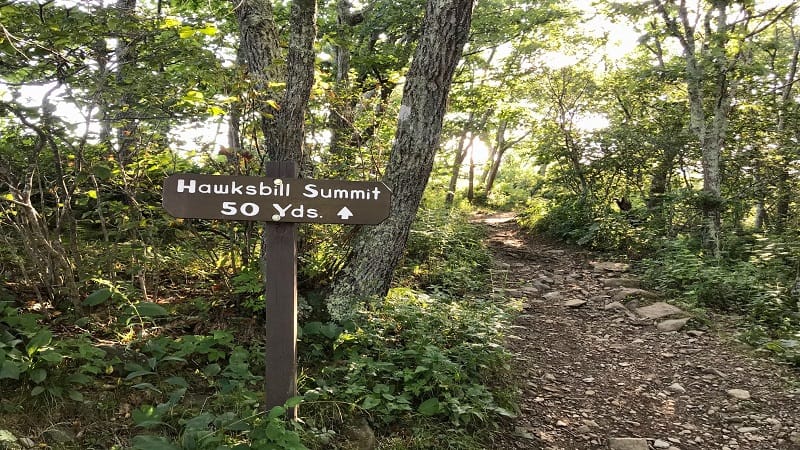
The hike to Hawksbill Summit at Shenandoah National Park is among the most popular in the park. It’s the park’s highest point at an elevation of 4,051 feet.
There are three ways to the top, but the 2.8-mile loop that starts at milepost 45.5 wows with a cool boulder field, as well as the rare Shenandoah Salamander.
Another popular route starts at the Upper Hawksbill parking area at milepost 46.7. This hike begins from a higher elevation point, but you will still feel the burn.
#8: Rose River Falls (milepost 49.5)
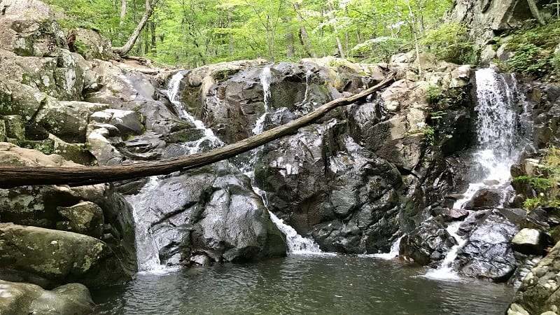
Not every waterfall hike comes with a dreamy swimming hole, which makes the 3.9-mile loop hike to 67-foot-tall Rose River Falls an easy one to love.
This hike begins at milepost 49.5 on Skyline Drive. This loop can be done in either direction, but counter-clockwise leads to Cave Cemetery at the 0.5-mile mark.
In a few more steps, you’ll reach a waterfall and a spur trail to Dark Hollow Falls. Keep walking parallel alongside Hogcamp Branch to Rose River Falls.
#9: Dark Hollow Falls (milepost 50.7)
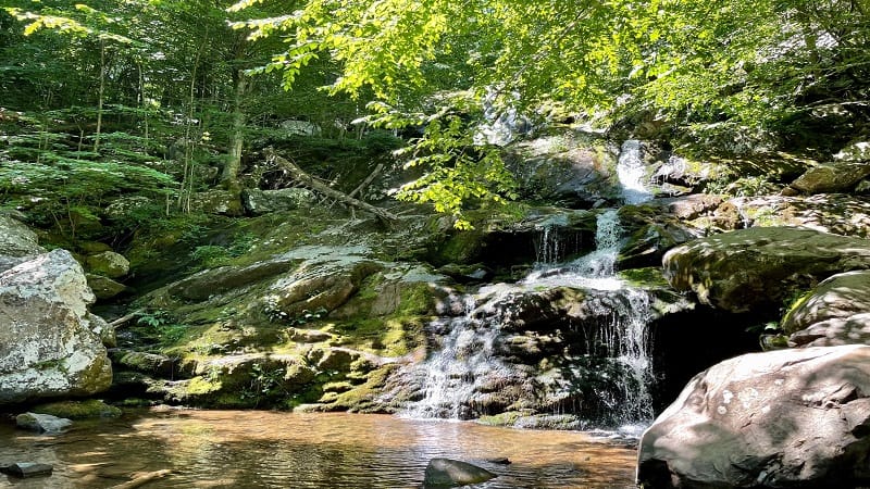
The 1.4-mile round-trip hike to 70-foot-tall Dark Hollow Falls is among the most popular Skyline Drive hikes. However, make note that this trail is not pet-friendly.
The elevation gain for the Dark Hollow Falls Trail (on the way back) is 400+ feet. In my opinion, it’s worth the burn for such striking waterfall views.
For a longer hike, I highly recommend a 6.9-mile loop hike that includes Rose River Falls and Dark Hollow Falls. It’s magical to hike to two waterfalls.
#10: Lewis Falls (milepost 51)
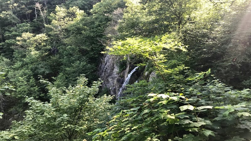
Lewis Falls may not be the tallest waterfall at Shenandoah National Park, but at 81 feet, it’s still pretty impressive.
It’s actually the fourth tallest waterfall in the park, though Overall Run Falls, which claims the honor as being the park’s tallest, is only 12 feet taller than Lewis Falls.
The 3.2-mile Lewis Spring Falls Trail (loop), which leads to Lewis Falls, is also notable for its sizeable parking lot, proximity to restrooms and ample picnic area.
#11: Big Rock Falls (milepost 51)
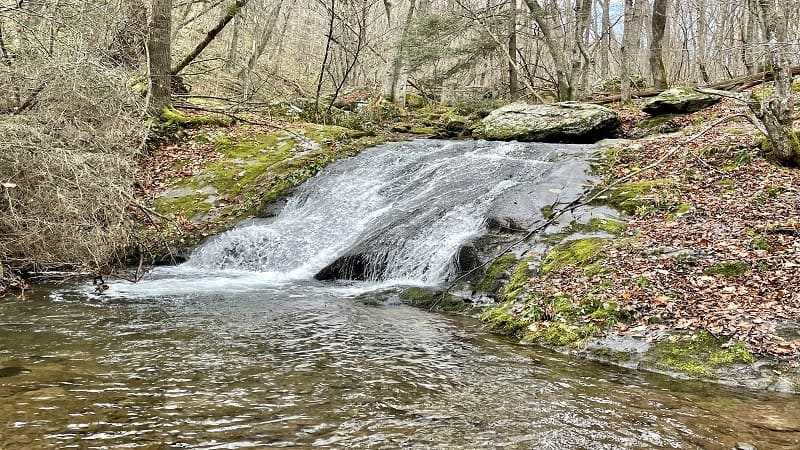
On the opposite side of Skyline Drive from Lewis Falls is the trailhead for the hike to Big Rock Falls. This waterfall is located on the blue-blazed Mill Prong Trail.
A 5.4-mile out-and-back hike leads hikers along the yellow-blazed Mill Prong Horse Trail. This quiet trail connects with the Mill Prong Trail after two miles.
Alternatively, revel in one of the smaller waterfalls on the way to Rapidan Camp. This 4.2-mile out-and-back hike is entirely along the Mill Prong Trail.
#12: Rapidan Camp (milepost 52.8)
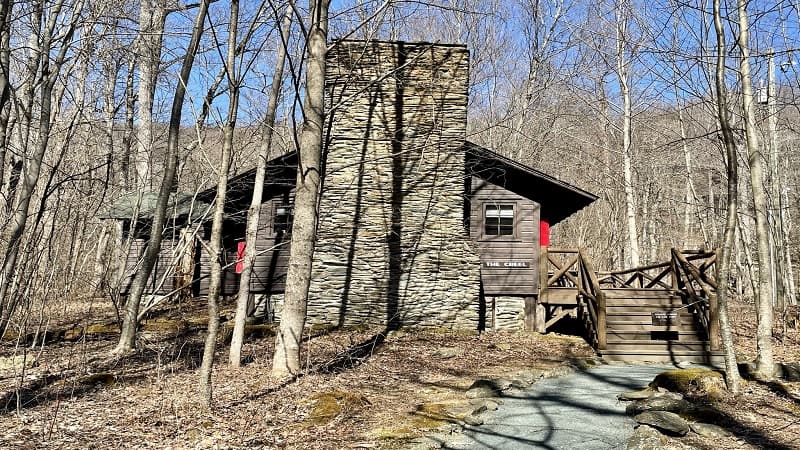
President Hoover frequented Rapidan Camp (also known as Camp Hoover) during the Great Depression, from 1929 to 1932. He loved to fish on the Rapidan River.
Hoover ultimately donated the 164-acre retreat to the National Park Service for incorporation into the soon-to-be-established Shenandoah National Park.
Today, a 4.2-mile out-and-back hike on the Mill Prong Trail leads to this national historic landmark, including three restored cabins.
#13: Bearfence Rock Scramble (milepost 56.4)
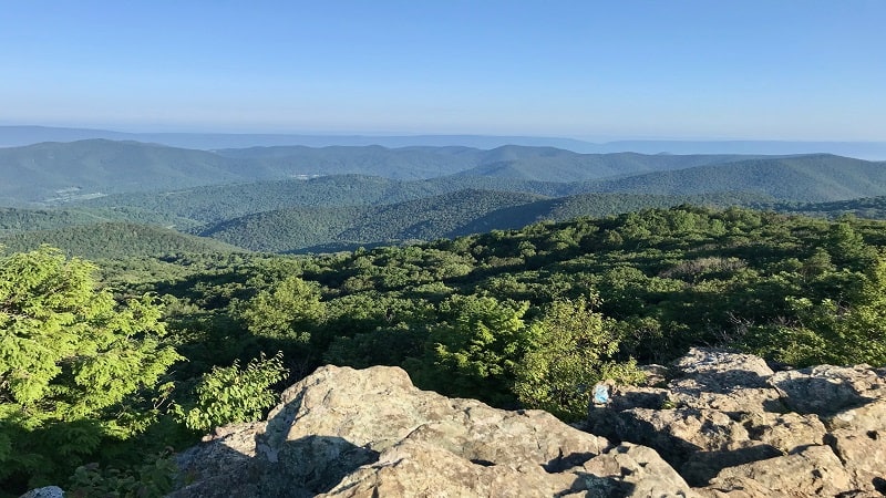
Reaching the summit of Bearfence Mountain (3,485 feet) by way of the Bearfence Loop Trail is a feat worthy of a spot on any hiker’s bucket list.
On a clear day, the mountains seem to go on forever (and ever). The far-reaching 360-degree payoff views after a hike of less than 0.45-mile are tremendous.
The short distance of this rocky hike can be deceptive. Use your hands, feet and arms, even knees to reach the top. It’s well worth every ounce of effort.
#14: Pocosin Trail (milepost 59.5)
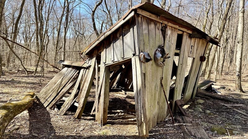
An easy 2.5-mile hike on the Pocosin Trail in the Central District of Shenandoah National Park quickly guides visitors to Pocosin Cabin.
Pocosin Cabin is one of six cabins maintained by the Potomac Appalachian Trail Club. The cabin was erected by the Civilian Conservation Corps (CCC) in 1937.
Shortly, you will reach the ruins of the Upper Pocosin Mission, which served the local mountain community in the days before the national park was established.
#15: South River Falls (milepost 62.8)
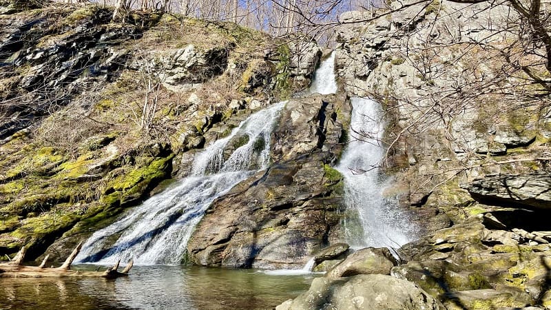
At 83 feet tall, South River Falls is among the tallest waterfalls at Shenandoah National Park. It’s a beauty and worth the overall elevation gain of 1,299 feet.
Tackle this hike as an out-and-back on the South River Falls Trail or as a loop by way of the South River Fire Road.
It’s a beautiful forested hike with a generous reward when you reach the falls. Look for plenty of rocks to sit on to enjoy a snack or re-fuel before the return hike.
#16: Old Rag (boundary trailhead)
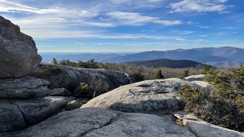
In 2019, Outside magazine named this 9.8-mile loop hike among the 25 best hikes in the world. Not even just in the United States. The entire world.
A mile of the Old Rag Mountain hike is an intense rock scramble. You’ll need to strategize rocky passages, slide down granite surfaces and navigate tight spaces.
A day-use ticket program runs from March 1 to November 30. For this hike, all hikers must select a hike date and purchase a day-use ticket at Recreation.gov.
#17: White Oak Canyon (boundary trailhead)
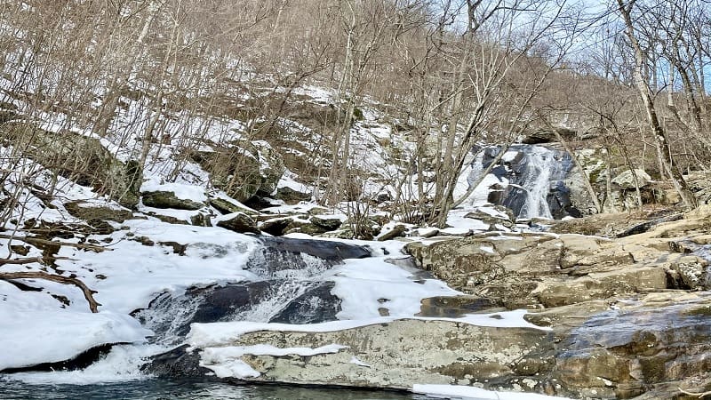
The 2.9-mile out-and-back hike on the White Oak Canyon Trail to Lower Whiteoak Falls from the boundary trailhead is so beautiful, so refreshing. So popular, too.
Cross over creeks and stroll across bridges as you walk the trail alongside the rolling Robinson River. Take in the burbles and babbles of the flowing cascades.
For a longer hike, try the 8.8-mile loop hike that goes to Upper White Oak Falls before the hike descends on more rocky terrain along the Cedar Run Trail.
#18: Broad Hollow Trail (boundary trailhead)
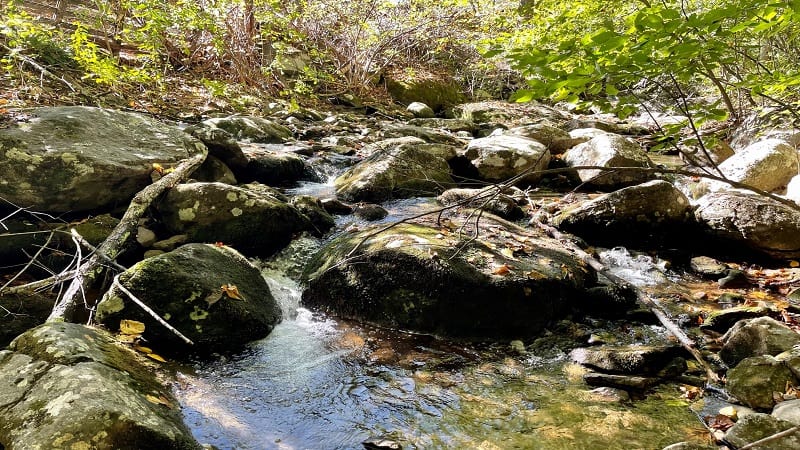
A quiet 6.2-mile loop hike, which includes the Broad Hollow Trail, Hazel Mountain Trail and Pine Gap Trail, begins at a boundary trailhead near Nethers.
In the first steps, you will cross over gently-flowing Broad Hollow Run. Then, at the 1.1-mile mark, you’ll see remains of an old wooden cabin.
This hike is best in late-fall and winter when you are rewarded with scenic views through leafless trees. Late in the hike, look for old, dilapidated trailers.
#19: Bear Church Rock (boundary trailhead)
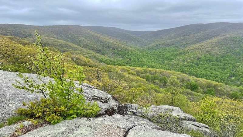
The strenuous 9.1-mile hike to Bear Church Rock has flowing rivers, a rock scramble, wide-open vistas and a small watering hole. It has so much for hikers.
Along the way, a side trail leads to Jones Mountain Cabin, one of six primitive cabins in the park maintained by the Potomac Appalachian Trail Club.
Take your time and enjoy the quiet serenity of the forest on this strenuous, but less-trafficked boundary hike in Shenandoah National Park.
#20: Robertson Mountain (boundary trailhead)
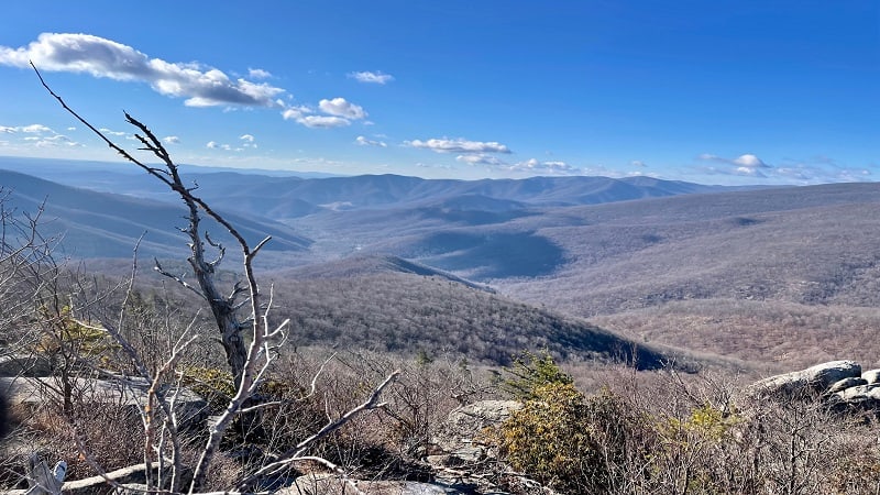
The 9.7-mile Roberson Mountain loop hike starts from the same lot as the Old Rag hike. There are no rock scrambles like Old Rag, but this is still a five-star hike.
It’s a rugged, merciless climb to the summit, but you’ll be glad you tackled this hike for the spectacular panoramas. Just be sure not to miss them.
At the 3.6-mile mark (counter-clockwise), an unmarked spur trail leads to the left for spectacular vistas from an elevation of 3,297 feet.
#21: Corbin Cabin (boundary trailhead)
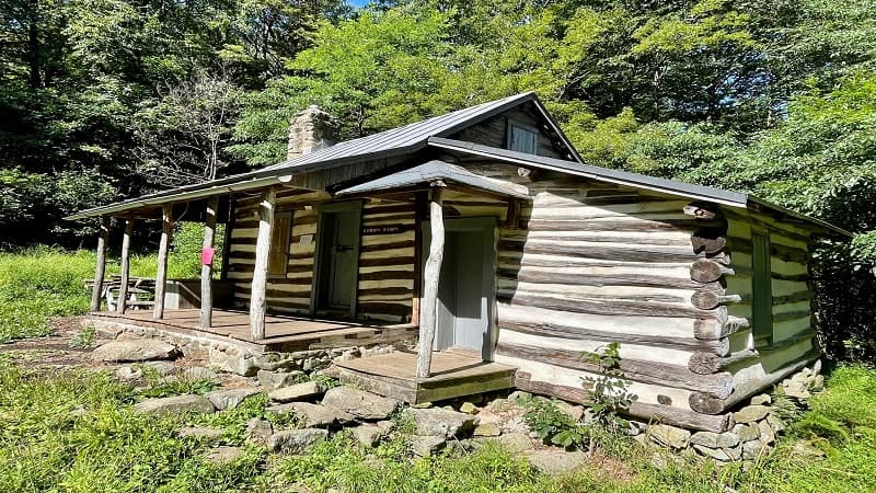
The 8.4-mile out-and-back hike to Corbin Cabin on the Nicholson Hollow Trail shares a parking lot with the Old Rag and Robertson Mountain hikes.
The trek to Corbin Cabin is a moderate climb, mostly alongside the burbling Hughes River. There are cascades and swimming holes all along the hiking trail.
Corbin Cabin is one of six primitive cabins within Shenandoah National Park that are owned and managed by the Potomac Appalachian Trail Club.

Erin Gifford has completed more than 300 hikes in Virginia. She is also the author of three hiking guidebooks from Falcon Guides. Need help finding a hike? Check out the Trail Finder feature or send Erin an email at [email protected].

