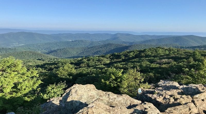
Bearfence Mountain: A Rock Scramble Hike to 360-Degree Views at Shenandoah National Park
The hike to the top of Bearfence Mountain by way of the Bearfence Loop Trail in Shenandoah National Park’s Central District is less than half-mile (one-way).
On a clear day, the mountains seem to go on forever. The far-reaching views are beyond tremendous. It’s easy to see why this is a favorite hike for a lot of people.
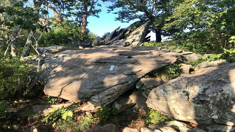
This short hike may have an elevation gain of just 167 feet, but don’t underestimate this Skyline Drive hike, especially the rock scramble to the top.
This trail can be heavily trafficked, but I wouldn’t be surprised to learn that many turn back before the summit. The final ascent can be intimidating.
The short distance of this rocky hike – called the Bearfence Rock Scramble Hike – can be deceptive. It’s also one of a few park hikes that do not allow dogs.
You will need to use your hands, feet and arms, even knees to reach the top. If you’re up for the challenge, however, it’s worth every ounce of effort.
| Trail Stats | |
|---|---|
| Length | 0.95 mile |
| Difficulty | Moderate |
| Trail Type | Loop |
| Elevation Gain | 242 feet |
| Duration | 1 hour |
| Terrain | Mostly dirt & gravel trails |
| Dog-Friendly | No |
| Fee | $30 per vehicle (good for seven days) |
| Driving Directions | Click Here |
Bearfence Mountain Hike
The Bearfence Mountain parking lot is situated at mile marker 56.4. You’ll find maybe a dozen parking spaces. Cross Skyline Drive to reach the trailhead.

In the parking lot, you’ll see a large trail sign outlining the Bearfence Rock Scramble Hike (the harder one) and the Bearfence Viewpoint Hike (the easier one).
The sign also provides a snapshot of the rocks (er, boulders) you can expect to deftly navigate on your way to the summit.
Bearfence Rock Scramble
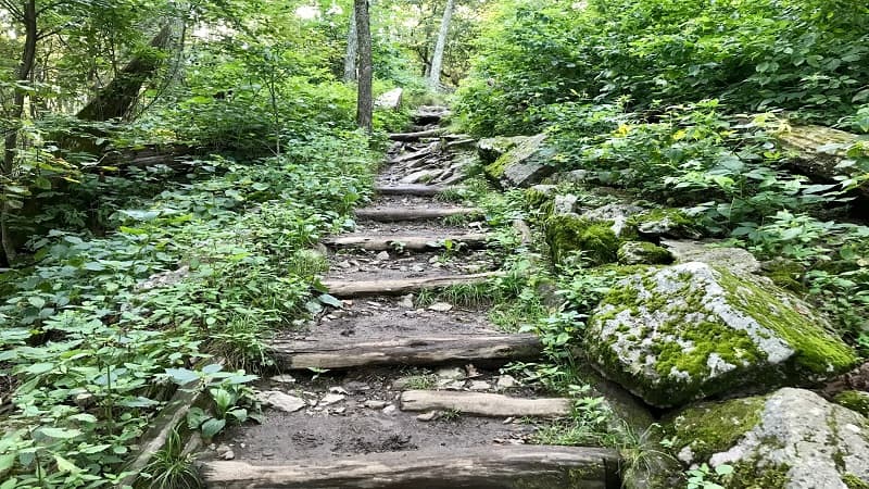
This blue-blazed trail commences simply enough, with a few dozen wooden steps built into the hillside.
At the 0.1 mile mark, you will reach a four-way intersection with the iconic white-blazed Appalachian Trail.
Continue straight ahead for the Bearfence Rock Scramble Hike. More steps guide you to the start of the short rock scramble.
As you stand facing several massive boulders, painted with blue blazes, you may think, this can’t possibly be the trail. But oh yes, it is.
From here, use hands and feet to navigate large and jagged rocks, even pull yourself up onto rocks, all while teetering close to the edge of the mountain.
Bearfence Mountain Summit
The rock scramble runs 0.15-mile before you (thankfully) reach the summit for 360-degree views of the Blue Ridge Mountains.
Once you reach the top of the rock scramble, settle in with the stellar views. Rehydrate and re-fuel with a snack. You may not want to ever return to your car.
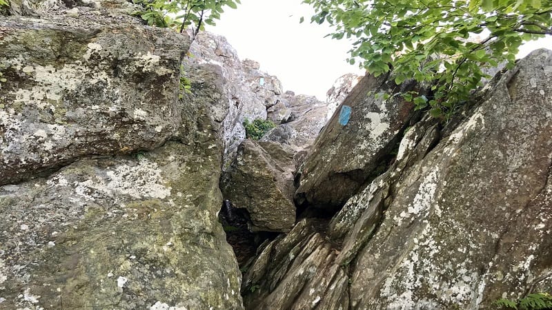
Continue on up and over the rocks until you reach an intersection with a connector trail at the 0.45-mile mark on the hike.
Turn right, then turn right again after a dozen or so steps. This will take you along the northbound Appalachian Trail.
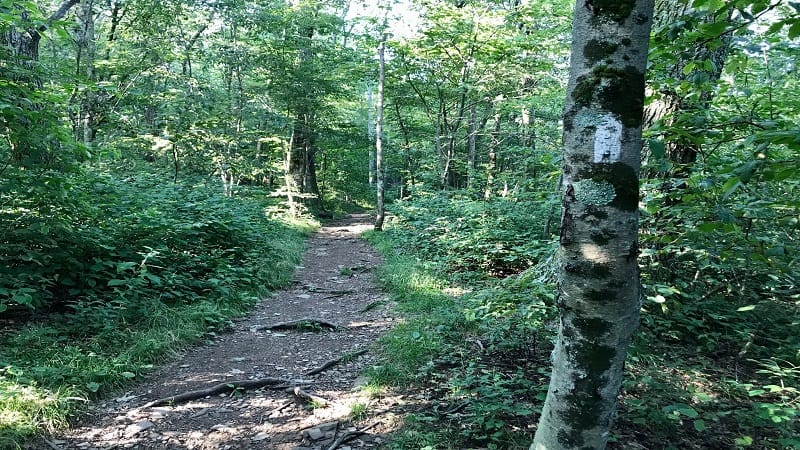
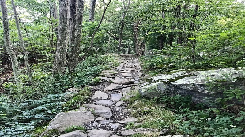
From here, it’s a well-shaded downhill along a trail of dirt, rocks and gravel. At the 0.75-mile-mark, you’ll reach a four-way junction.
Make a left turn to descend the stairs and return to the parking lot to wrap up this scenic, though challenging, lollipop hike. Plan on 45-60 minutes for this hike.
Bearfence Viewpoint Hike
I actually checked out both the Bearfence Rock Scramble Hike and the Bearfence Viewpoint Hike to compare the two since I was there.
Both hikes begin the same way, with a mild ascent up the stairs to the intersection with the white-blazed Appalachian Trail at the 0.1-mile mark.
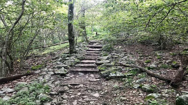
Instead of continuing straight ahead on the blue-blazed Bearfence Loop Trail, turn right onto the Appalachian Trail for the Bearfence Viewpoint Hike.
Begin with an ascent south on the trail on a shaded, dirt and gravel path. After 0.35-mile, turn left onto a connecter trail. It’s a handful of steps to a T-intersection.
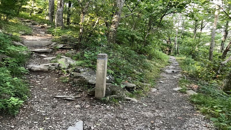
Turn right at the T-intersection. From here, it’s just 25 yards to the viewpoint (according to the trail marker), though it is a fairly steep climb.
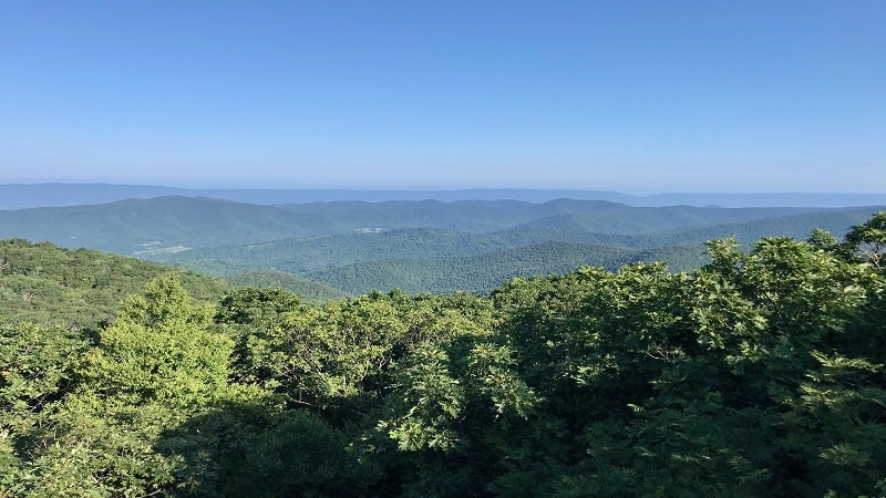
The viewpoint wows with nice views across the Shenandoah Valley. There are several large rocks that are perfect for taking a rest.
This day hike clocks in at 0.95-mile, so it’s longer than the Bearfence Rock Scramble Hike. It also skips the rock scrambling entirely.
The overlook offers 180-degree views rather than 360-degree views. Still, it’s a nice hike, especially with small children. Plan on 30-45 minutes for this hike.
Hike Option
For a few more steps, and to be able to enjoy the viewing points for both hikes, connect the two for a hike that clocks in at just over one mile.
To do this, start with the Bearfence Rock Scramble Hike. Once you’ve hiked up and over the summit, you will reach a trail marker.
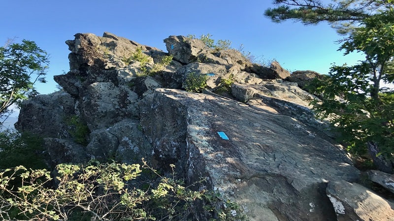
Rather than turning right onto the connector trail, continue straight ahead. This will guide you to the scenic 180-degree viewpoint.
Once you’ve taken in all the best views, turn right (instead of left) onto the main trail. Shortly, you will reach an intersection with the Appalachian Trail.
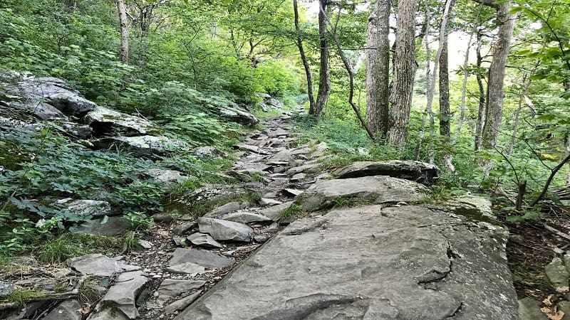
Turn right onto the Appalachian Trail. Take this to the trail junction with stairs on both sides. Turn left and you are within 0.1-mile of the small parking lot.
Wrap-Up Notes
Yes, the Bearfence Rock Scramble can be a challenging hike, but it can be safely done, even with young children. However, a few notes for you.
Do not even attempt this short trail if it is wet or icy. It’s one of the park’s most popular hikes, but the rock scramble route will be dangerously slippery.
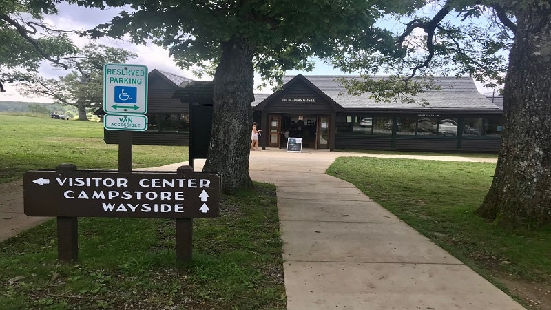
Once you complete the Bearfence hike, you will very much deserve a treat, or at the very least, an icy cold beverage to celebrate this fun day hike.
It’s a five-mile drive north to Big Meadows at milepost 51. Here you’ll find a gas station, a restaurant, a large picnic area and a visitors center.

You’ll also find Big Meadows Wayside, a large convenience store with grab-and-go sandwiches, loads of snacks and camping supplies.
As a bonus, there have ice cream bars, cold drinks (even beer and wine) and all kinds of souvenirs. Restrooms are located on the right-hand side of the building.

Erin Gifford has completed more than 300 hikes in Virginia. She is also the author of three hiking guidebooks from Falcon Guides. Need help finding a hike? Check out the Trail Finder feature or send Erin an email at [email protected].

