Hike to 13 Waterfalls at Shenandoah National Park in Virginia
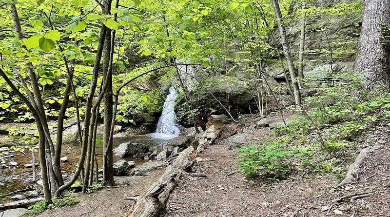
More than a dozen spectacular waterfalls in Shenandoah National Park can be reached by way of hiking trails. The majority are accessible via Skyline Drive.
Overall Run Falls is the tallest waterfall in the park, standing proud at 93 feet tall. However, Dark Hollow Falls is Shenandoah’s most visited waterfall.
Shenandoah Waterfall Hikes
Hikes to incredible waterfalls range from an easy 1.3-mile out-and-back hike to Lands Run Falls to a strenuous 8.8-mile loop hike to see Whiteoak Canyon Falls.
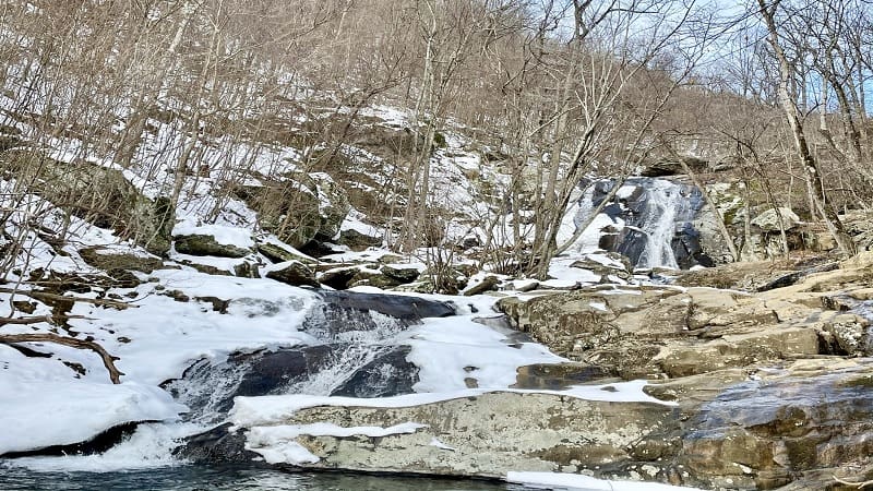
Some of the most popular waterfalls at Shenandoah National Park have swimming holes, like South River Falls. Some even have caves, like Hazel Falls.
Several hikes allow you to see two popular waterfalls, like the loop hike that includes Jones Run Falls and Doyles River Falls. Gorgeous.
A second popular loop features Dark Hollow Falls and Rose River Falls. As a bonus, this hike is a stone’s throw from snacks and souvenirs at Big Meadows.
Skyline Drive Waterfalls
Nine of the waterfall hikes at Shenandoah National Park begin from trailheads along winding 105-mile Skyline Drive, which runs the length of the park.
You can reach Overall Run Falls and the two White Oak Canyon waterfalls from Skyline Drive, but a start from boundary trailheads is highly recommended.
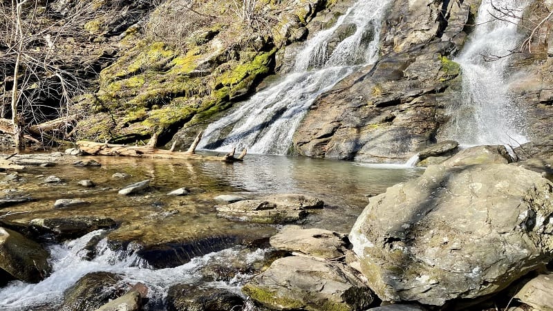
Favorite Skyline Drive waterfall hikes include Dark Hollow Falls, South River Falls and Jones Run Falls. I love these waterfalls. They are the most photogenic.
From north to south, here are the Shenandoah National Park waterfalls along Skyline Drive that can be reached by hiking trails.
I’ve also included four Shenandoah waterfalls that are best reached by way of boundary trailheads located near Bentonville, Crozet and Syria.
#1: Lands Run Falls (milepost 9.2)
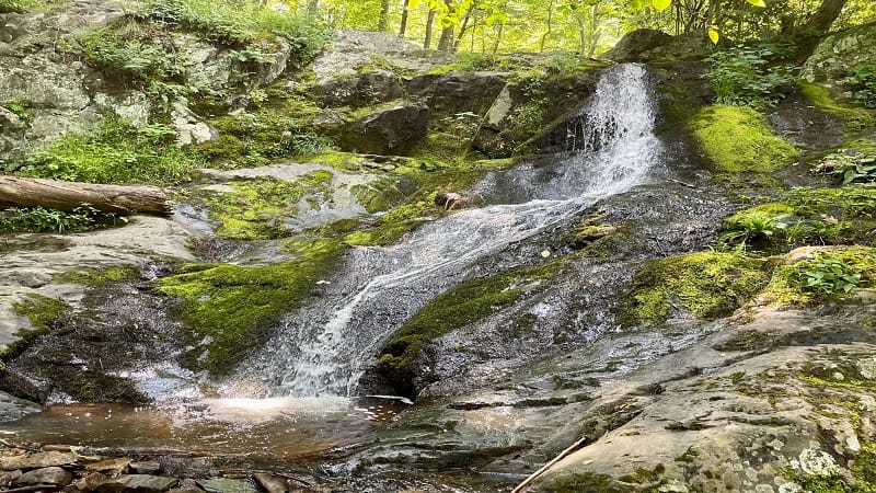
It’s an easy 1.3-mile out-and-back hike to Lands Run Falls by way of the Lands Run Fire Road. However, there is no safe and easy way to see the falls.
You could easily miss Lands Run Falls if you walk too quickly on the fire road. Once you reach trickling Lands Run, cross a bridge and you have arrived.
Lands Run Falls is on your right, but it’s a steep downhill walk to see the falls. This short hike leads to the closest waterfall to the park’s north entrance.
#2: Hazel Falls (milepost 33.5)
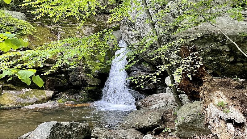
The 5.2-mile out-and-back hike to Hazel Falls (aka Cave Falls) begins at the Meadow Spring parking lot at mile marker 33.5.
Your first steps are on the yellow-blazed Hazel Mountain Trail. It’s a rugged descent along this forested trail. Listen for the burbling of the Hazel River.
Personally, I like Hazel Falls because it has a waterfall and a watering hole. There are cascades and caves, too. This shaded area is perfect for lunch or a snack.
#3: Rose River Falls (milepost 49.5)
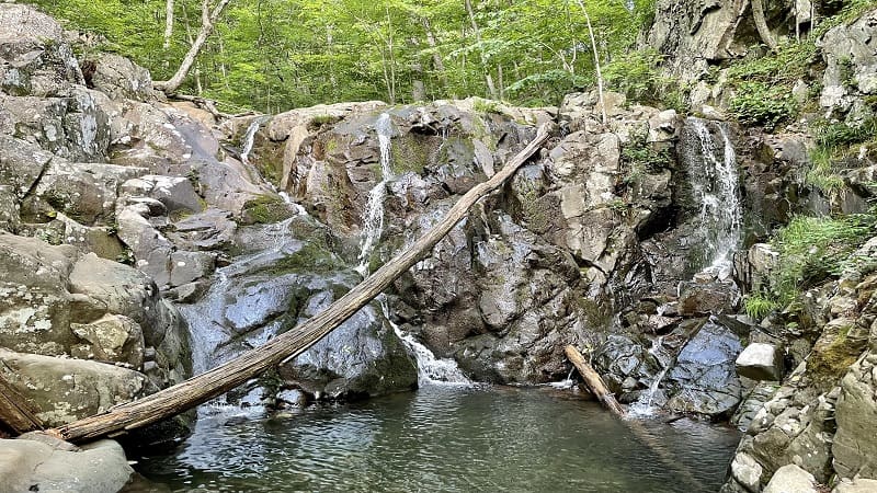
Not every waterfall hike can claim a refreshing swimming hole, but that’s what makes the 3.9-mile loop hike to 67-foot-tall Rose River Falls one to love.
This wooded loop can be completed in either direction, but I recommend counter-clockwise to see the historic Cave Cemetery at the 0.5-mile mark.
Soon, you’ll approach a tumbling waterfall and a spur trail to Dark Hollow Falls. Walk parallel to Hogcamp Branch to continue on to Rose River Falls.
#4: Dark Hollow Falls (milepost 50.7)
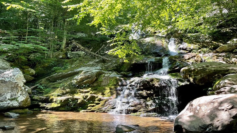
The 1.4-mile round-trip hike to 70-foot-tall Dark Hollow Falls is among the most popular Skyline Drive hikes. However, do note, this trail is not pet-friendly.
The elevation gain for the Dark Hollow Falls Trail (on the way back) is 400+ feet. In my opinion, it’s worth the burn for such striking waterfall views.
For a longer hike, you can complete a 4.7-mile loop hike. I highly recommend a 6.9-mile loop hike that includes Rose River Falls and Dark Hollow Falls.
#5: Lewis Falls (milepost 51)
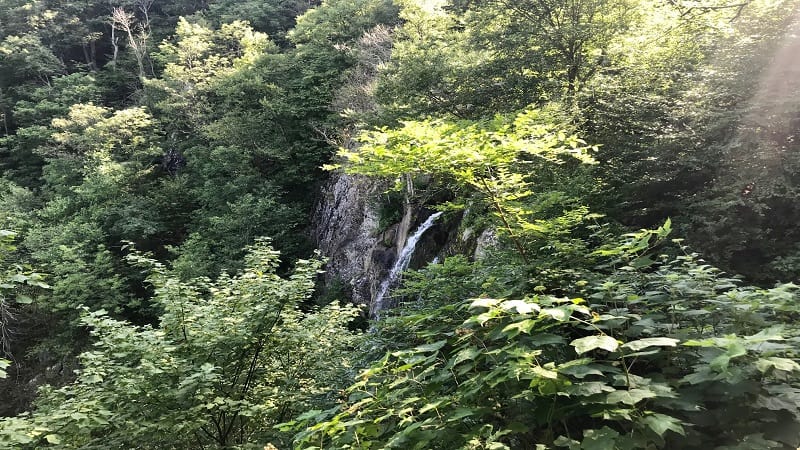
Lewis Falls may not be the tallest waterfall at Shenandoah National Park, but at 81 feet tall, it’s mighty impressive, especially from the observation point.
It’s the fourth tallest waterfall in the park. Overall Run Falls is the tallest waterfall in Shenandoah National Park, but it’s just 12 feet taller than Lewis Falls.
The 3.2-mile loop hike starts on the Lewis Falls Trail and includes steps along the Appalachian Trail. At the trailhead, look for flush toilets and a picnic area.
#6: Big Rock Falls (milepost 51)
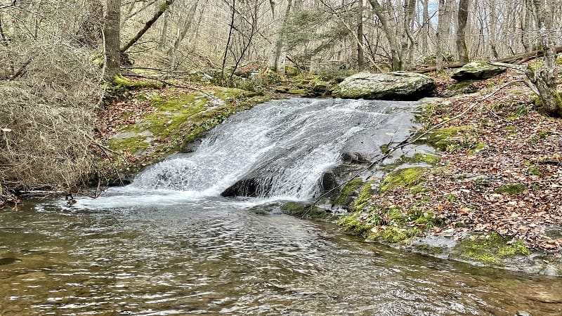
On the opposite side of Skyline Drive from Lewis Falls is the start of the hike to Big Rock Falls. This waterfall is located on the blue-blazed Mill Prong Trail.
A 5.4-mile out-and-back hike guides hikers along the yellow-blazed Mill Prong Horse Trail. This quiet trail connects with the Mill Prong Trail after two miles.
Alternatively, you can revel in one of the smaller waterfalls on the way to Rapidan Camp. This 4.2-mile out-and-back hike is entirely along the Mill Prong Trail.
#7: South River Falls (milepost 62.7)
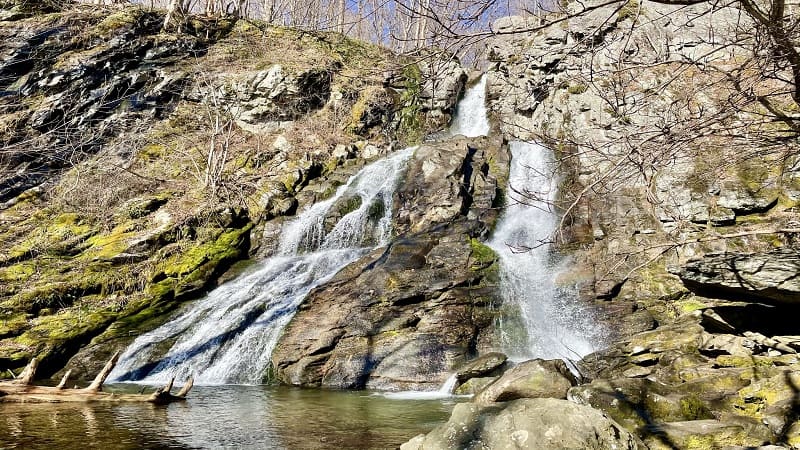
At 83 feet tall, South River Falls is the third tallest waterfall at Shenandoah National Park. I love this hike. It’s well worth a higher elevation gain of 1,299 feet.
I started this hike at the South River Picnic Grounds. It can be done as a 5.1-mile loop hike by way of the South River Falls Trail and South River Fire Road.
You’ll catch a glimpse of the falls from the stone observation platform at the 1.4-mile mark. Press on for a better view from from the base of the falls.
#8: Doyles River Falls (milepost 81.1)
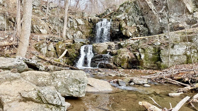
The 3.6-mile round trip hike to Doyles River Falls includes Upper Falls and Lower Falls, as well as Doyles River Cabin, a PATC-managed cabin in the park.
Upper Falls is 28 feet tall while Lower Falls is 63 feet tall. For flowing cascades, I suggest that you do this moderate hike between late-fall and early-spring.
Doyles River Cabin was built in 1936 by laborers and artisans with the Civilian Conservation Corps (CCC). From the porch, revel in views of Cedar Mountain.
#9: Jones Run Falls (milepost 84.1)
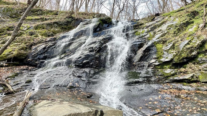
There are two ways to see 42-foot-tall Jones Run Falls. You can either complete a 4.5-mile out-and-back hike or a 7.0-mile loop hike.
The loop hike includes Doyles River Falls, which is less than two miles from Jones Run Falls. If you’ve got it in you, I recommend the loop to see both falls.
Jones Run Falls is gorgeous. I noted that there were lots of rocks to take a seat for a lunch break in front of the falls. Savor the cascades along Jones Run, too.
#10: Overall Run Falls (boundary trail)
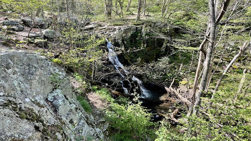
This 8.8-mile hike begins on the Thompson Hollow Trail. At the 1.0-mile mark, turn right onto the Beecher-Overall Run Trail. Do not miss the swimming hole.
You’ll catch your first views of 93-foot-tall Overall Run Falls from a rocky overlook at the 5.7-mile mark. This is the first of three wide-open overlooks.
Unfortunately, there is no safe way to reach the base of the park’s highest waterfall. However, the far-reaching mountain views are the real star of this hike.
#11: Lower Whiteoak Falls (boundary trail)
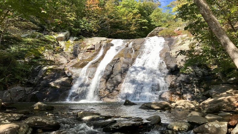
The 2.9-mile out-and-back hike on the Whiteoak Canyon Trail to Lower Whiteoak Falls is refreshing. It’s also one of the most popular waterfall hikes.
Plan to cross creeks and stroll across bridges as you hike alongside the rolling Robinson River. Take in the burbles and babbles of the distinct cascades.
Scramble rocks to the basin of Lower Whiteoak Falls. The refreshing swimming hole is wildly popular in warm summer months.
#12: Upper Whiteoak Falls (boundary trail)
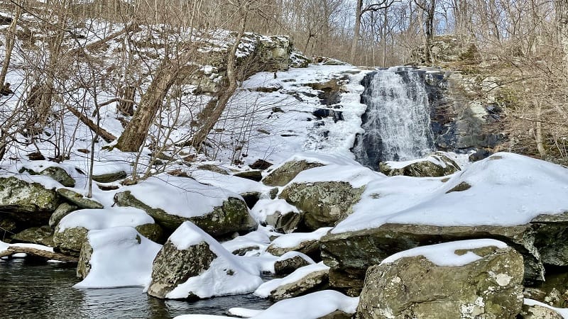
For a longer hike, which includes Lower Whiteoak Falls and Upper Whiteoak Falls, tackle the 8.8-mile loop hike that wows with oasis-like water views.
Once you pass Lower Whiteoak Falls at the 1.4-mile mark, continue ascending to Upper Whiteoak Falls, which comes into view at the 2.4-mile mark.
Press on to reach the Cedar Run Trail. You’ll descend on mostly rocky terrain to close the loop and finish up this scenic wooded hike.
#13: Big Branch Falls (boundary trail)
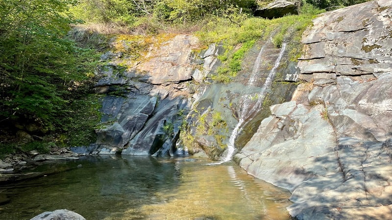
A 4.7-mile out-and-back hike to Big Branch Falls begins from the parking area for the Sugar Hollow Reservoir. Look for a red gate on the lot’s west side.
This enjoyable waterfall hike follows the North Fork Moormans River and features several easy river crossings along the way.
At the 2.2-mile mark, a blue-blazed spur trail leads to Big Branch Falls. I loved that there is a gently-flowing waterfall and a small yet refreshing swimming hole.

Erin Gifford has completed more than 300 hikes in Virginia. She is also the author of three hiking guidebooks from Falcon Guides. Need help finding a hike? Check out the Trail Finder feature or send Erin an email at [email protected].

