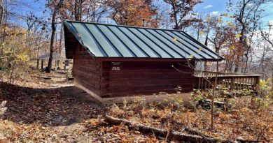
15 Best Appalachian Trail Day Hikes in Virginia
Virginia has 500+ Appalachian Trail miles, more than any other state, with the route crossing the Blue Ridge, Shenandoah National Park and Southwest Virginia
My top Appalachian Trail day hikes are McAfee Knob, Mount Rogers, Dragon’s Tooth and Tinker Cliffs. For 360-degree views, hike to Spy Rock.

I’ve completed more than 300 hikes across Virginia and written three Virginia hiking guidebooks for Falcon Guides. I’ve personally hiked every trail on this list.
I focused on hikes where the Appalachian Trail is a meaningful part of the experience, rather than routes that briefly cross or touch the AT.
Where the Appalachian Trail Runs Through Virginia
Across Virginia, the Appalachian Trail connects Northern Virginia overlooks, Shenandoah summits and the highlands of Southwest Virginia.
For planning, these hikes fall naturally into five regions:
- Northern Virginia: Bears Den, Raven Rocks
- Shenandoah National Park: Mary’s Rock, Compton Peak
- Central Virginia / Blue Ridge Parkway: Humpback Rocks, Spy Rock, The Priest, Apple Orchard Mountain
- Roanoke / Catawba: Dragon’s Tooth, McAfee Knob, Tinker Cliffs
- Southwest Virginia: Angel’s Rest, Sinking Creek/Keffer Oak, Mount Rogers, Wilburn Ridge
Best Virginia Appalachian Trail Day Hikes at a Glance
Below are 15 of my favorite Appalachian Trail day hikes in Virginia, from short overlooks to full-day climbs and longer section hikes.
| Hike | Location | Mileage | Difficulty | Best For |
|---|---|---|---|---|
| McAfee Knob | Catawba | 8.0 miles | Moderate | Best overall |
| Mount Rogers | Mouth of Wilson | 9.0 miles | Moderate | Virginia highpoint |
| Dragon's Tooth | Catawba | 4.8 miles | Strenuous | Rock scramble |
| Tinker Cliffs | Troutville | 8.1 miles | Moderate | Ridge views |
| The Priest | Tyro | 9.0 miles | Strenuous | Endurance |
| Raven Rocks | Bluemont | 5.1 miles | Strenuous | Northern Virginia |
| Spy Rock | Montebello | 5.9 miles | Moderate | 360-degree views |
| Humpback Rocks | Blue Ridge Parkway | 4.3 miles | Strenuous | Quick payoff |
| Wilburn Ridge | Grayson Highlands State Park | 4.4 miles | Moderate | Wild ponies |
| Angel's Rest | Pearisburg | 5.0 miles | Strenuous | Two viewpoints |
| Mary's Rock | Shenandoah National Park | 3.7 miles | Moderate | Shenandoah AT hike |
| Apple Orchard Mountain | Blue Ridge Parkway | 5.3 miles | Easy | Blue Ridge Parkway |
| Bears Den Overlook | Bluemont | 1.4 miles | Easy-Moderate | Easy AT hike |
| Compton Peak | Shenandoah National Park | 2.4 miles | Moderate | Geology |
| Sinking Creek/Keffer Oak | Blacksburg | 11.3 miles | Strenuous | True AT section hike |
#1: McAfee Knob (Catawba)
8.0 miles | Moderate | 5–6 hrs | Best overall hike

McAfee Knob earns its reputation with an eight-mile round trip, 1,654 feet of climbing and an iconic rock ledge above sweeping valley views.
I’ve hiked it twice, once on the Appalachian Trail and once using the McAfee Knob Trail/fire road route. The AT route passes two shelters.
Parking can be the trickiest part, so plan ahead. A seasonal shuttle is also available, making trailhead logistics easier during busier times.
#2: Mount Rogers (Mouth of Wilson)
9.0 miles | Moderate | 4–5 hrs | Best Virginia highpoint hike

Mount Rogers rises to 5,730 feet, making it Virginia’s highest natural point and a worthy goal for hikers chasing state highpoints.
I took the Elk Garden route, a nine-mile round-trip hike that follows much of the Appalachian Trail through grassy highlands and wide-open mountain scenery.
The summit itself is wooded and surprisingly viewless. You can also approach from Massie Gap, but Elk Garden offers a more direct route.
#3: Dragon’s Tooth (Catawba)
4.8 miles | Strenuous | 3–4 hrs | Best rock scramble

Dragon’s Tooth turns technical near the top, where the Appalachian Trail tackles steep rock, iron bars and hands-and-feet scrambling on the way to the spire.
I found the final 0.8 miles far tougher than the approach, with sections that feel more like climbing than hiking.
This 4.8-mile Virginia Triple Crown hike is best saved for dry weather. The scramble is the challenge, and the rock formation is the reward.
#4: Tinker Cliffs (Troutville)
8.1 miles | Moderate | 4–5 hrs | Best for ridge views

The Tinker Cliffs hike stretches 8.1 miles along the Andy Layne Trail and Appalachian Trail, with cow pastures, creek crossings and footbridges.
It’s my favorite Virginia Triple Crown hike, largely because the payoff keeps going. The AT follows the bluffs past multiple rocky overlooks, not just one.
Expect more than 100 steps, then roughly 60 more. The ridge stays quieter than McAfee Knob, with big Catawba and Roanoke Valley views.
#5: The Priest (Tyro)
9.0 miles | Strenuous | 6–7 hrs | Best endurance hike

The Priest climbs relentlessly for nine miles round trip, following the Appalachian Trail to 4,063-foot Priest Mountain, the highest point in Nelson County.
I remember the 30-plus switchbacks well. With more than 3,000 feet of climbing, this is a hike that makes you earn every overlook.
A rocky viewpoint below the summit delivers the biggest scenery, while Priest Shelter sits nearby on the AT. This one is all about the climb.
#6: Raven Rocks (Bluemont)
5.1 miles | Strenuous | 3–4 hrs | Best Northern Virginia AT hike

Raven Rocks follows the Appalachian Trail for 5.1 miles, climbing and dropping repeatedly before reaching a cliffside overlook above the Shenandoah Valley.
Those constant ups and downs are what stand out most from this hike. The trail rarely stays level, and the final overlook feels hard-earned.
Watch for the Virginia-West Virginia state-line sign along the way. Fall color and sunrise can be beautiful here, but the parking area fills quickly.
#7: Spy Rock (Montebello)
5.9 miles | Moderate | 3–4 hrs | Best 360-degree views

Spy Rock rewards 5.9 miles of hiking with a wide-open summit and 360-degree views across the Blue Ridge.
Most of the climb follows the Appalachian Trail before a short spur and brief rock scramble lead to the top. Fall is especially beautiful here.
The summit is the kind of place that makes you stop for a while, with mountain views stretching in every direction.
#8: Humpback Rocks (Nellysford)
4.3 miles | Strenuous | 2.5–4 hrs | Best quick payoff

For this one, take the 4.3-mile loop: a steep climb to Humpback Rocks, then a gentler return on the Appalachian Trail.
The rocky summit is the big reward, with broad Blue Ridge views after the 1,099-foot climb. I prefer the loop over retracing the direct route.
The AT makes the descent feel less abrupt, though the hike still earns its strenuous label. Arrive early—the small parking lot fills quickly.
#9: Wilburn Ridge (Mouth of Wilson)
4.4 miles | Moderate | 2–3 hrs | Best for wild ponies

From Massie Gap, this 4.4-mile hike heads onto the Appalachian Trail through open balds and some of Virginia’s most distinctive high-country scenery.
The wild ponies are the headline, but the landscape is what stayed with me: broad meadows, exposed ridges and rhododendron when it’s in bloom.
A rocky outcrop around mile two adds another payoff before the trail continues toward Wilburn Ridge through terrain that feels almost alpine.
#10: Angel’s Rest (Pearisburg)
5.0 miles | Strenuous | 3–4 hrs | Best for two viewpoints

Angel’s Rest climbs steeply from Pearisburg on the southbound Appalachian Trail, with more than a dozen switchbacks packed into this five-mile hike.
The first payoff comes at Angel’s Rest, but I kept going to the Wilburn Valley overlook for a second round of mountain views.
Don’t let the mileage fool you. With 1,709 feet of gain, this is a short, demanding hike that makes you work for both overlooks.
#11: Mary’s Rock (Shenandoah NP)
3.7 miles | Moderate | 2.5–3 hrs | Best Shenandoah AT hike

From Panorama at Thornton Gap, the 3.7-mile route to Mary’s Rock follows the Appalachian Trail for nearly the entire climb.
The trail gains steadily before a short spur leads to the rocky summit, where Shenandoah Valley and Massanutten views open up.
I like this route for the strong AT experience and big summit payoff. Panorama also has a large parking area and restrooms near the trailhead.
#12: Apple Orchard Mountain (Bedford)
5.3 miles | Easy | 3–4 hrs | Best Blue Ridge Parkway AT hike

Apple Orchard Mountain starts strong at Thunder Ridge Overlook, where a stone viewing deck opens to wide Arnold Valley views along the Blue Ridge Parkway.
From there, the 5.3-mile route follows the southbound Appalachian Trail through mostly wooded terrain, making it feel gentler than many AT hikes nearby.
A short spur leads to Thunder Hill Shelter, while the summit adds a rocky outcrop. By Appalachian Trail standards, this is a relatively easy outing.
#13: Bears Den Overlook (Bluemont)
1.4 miles | Easy-Moderate | 1 hr | Best easy AT hike

Bears Den Overlook is a short, family-friendly Appalachian Trail hike near Snickers Gap, with Shenandoah Valley views after less than two miles.
I’ve always liked how quickly this trail delivers. Roots, boulders and rocky footing keep the walk interesting without making it especially difficult.
The overlook is especially good near sunset, and it also marks one end of Northern Virginia’s famous AT “Roller Coaster.”
#14: Compton Peak (Shenandoah NP)
2.4 miles | Moderate | 1.5–2 hrs | Best geology hike

Compton Peak starts with a 0.8-mile climb on the Appalachian Trail from Compton Gap, then splits into two short spur trails worth taking.
I did both, and they feel completely different: one leads to a west-facing overlook, while the other drops toward striking columnar jointing.
The full hike is just 2.4 miles, but the mix of mountain views and unusual geology makes this one especially memorable.
#15: Sinking Creek/Keffer Oak (Blacksburg)
11.3 miles | Strenuous | 6–7 hrs | Best true AT section hike

For a true day on the Appalachian Trail, hike 11.3 miles point-to-point from Sinking Creek to Lee Hollow across Sinking Creek Mountain.
Keffer Oak appears early, followed by long ridge stretches, two shelters and plenty of quiet trail time. I nearly walked right past the famous oak.
This one takes more planning, since you’ll need a car shuttle between trailheads, but it feels much more like a genuine AT section hike.
How I Chose These Appalachian Trail Hikes

I’ve hiked every trail on this list, and I chose them for variety as much as scenery.
Some are short overlooks, while others are full-day climbs or longer section hikes. Together, they show how different the Appalachian Trail feels across Virginia.
I also favored routes with a strong sense of place, whether that means wild ponies, rock scrambles, shelters, ridgelines or iconic viewpoints.
Frequently Asked Questions

What is the best Appalachian Trail day hike in Virginia?
McAfee Knob is my pick for the best overall Appalachian Trail day hike in Virginia.
The 8-mile route follows a scenic stretch of the AT to one of the most recognizable viewpoints in the state.
What is the hardest Appalachian Trail day hike in Virginia?
There are plenty of contenders, but for me, The Priest is the toughest AT hike here, climbing more than 3,000 feet over nine miles.
What is the best easy Appalachian Trail hike in Virginia?

Bears Den Overlook is one of the easiest ways to experience the Appalachian Trail in Virginia. The short hike reaches an overlook with Shenandoah Valley views.
What is the best Appalachian Trail hike in Shenandoah National Park?
Mary’s Rock is my pick for the best AT day hike in Shenandoah National Park.
The 3.7-mile route from Panorama follows the Appalachian Trail for most of the climb to the summit.
Can you day hike the Appalachian Trail in Virginia?
Yes. Virginia has hundreds of miles of Appalachian Trail, and many trailheads allow hikers to experience sections of the AT without backpacking or thru-hiking.

Erin Gifford has completed more than 300 hikes in Virginia. She is also the author of three hiking guidebooks from Falcon Guides. Need help finding a hike? Check out the Trail Finder feature or send Erin an email at [email protected].