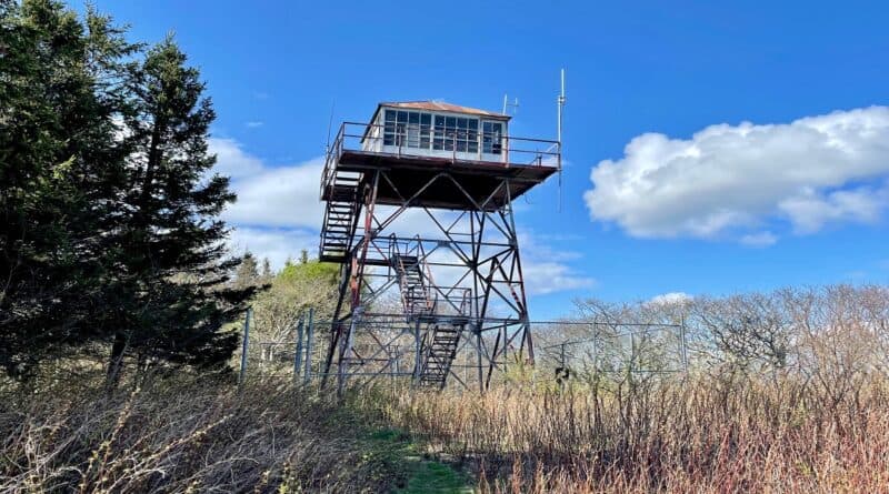
Elliott Knob: Hike to an Old Fire Lookout Tower Near Staunton, Virginia
The 9.2-mile out-and-back hike to Elliott Knob near Staunton, Virginia is challenging, but it rewards with panoramas from atop the three-story fire tower.
There’s no question, this hike will torch calories, especially the fourth mile when the elevation gain tops 900 feet. You’ve got this. Just take it slow.
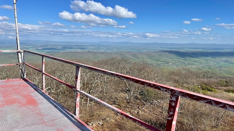
At an elevation of 4,463 feet, Elliott Knob is the highest point in Augusta County. It’s also the tallest peak in the Shenandoah Mountain Valley Region.
Elliott Knob forms the crest of the Great North Mountain. The vistas are wonderful, but you definitely have to earn all of the great views.
Along the way, revel in the views of a cascading creek as you ascend one of the highest mountains in Virginia, with views across the Shenandoah Valley.
| Trail Stats | |
|---|---|
| Length | 9.2 miles |
| Difficulty | Strenuous |
| Trail Type | Out-and-Back |
| Elevation Gain | 2,434 feet |
| Duration | 5-6 hours |
| Terrain | Mostly grass, dirt & gravel trails |
| Dog-Friendly | Yes |
| Fee | Free |
| Driving Directions | Click Here |
Trail Parking
This hike begins from a small parking area on Little Calf Pasture Highway. I hesitate to call it a parking lot since there is room for just two or three cars.
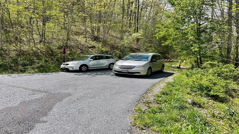
The lot is just 0.2 miles south of the entrance to the Shenandale Gun Club. Keep your eyes open for a fire road on the right, which is where you will park.
There is nowhere else to park since Little Calf Pasture Highway is a fast-moving road. You cannot parallel park. If the lot is full, find another hike.
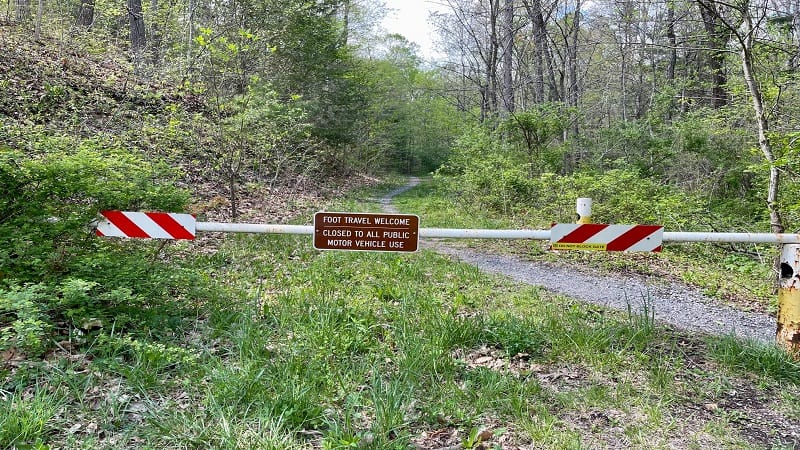
Once you park, you will see an iron gate restricting motor vehicles. However, as the sign on the gate states, “Foot Travel Welcome.” The hike starts here.
Falls Hollow Trail
The hike to Elliott Knob in the George Washington National Forest begins on the Falls Hollow Trail. A trail sign appears within the first steps of this hike.
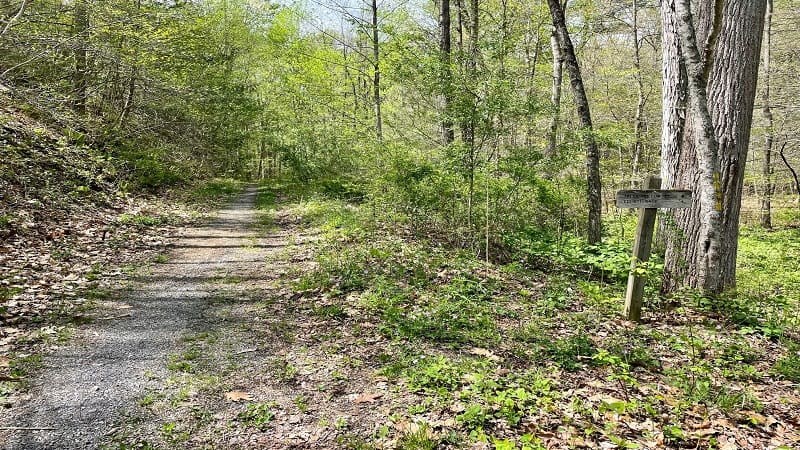
From here, it’s a very mild ascent on a grass and gravel trail. Don’t let yourself be fooled by the start of this hike. This is a warm-up for the climb to come.
Continue on, following the yellow blazes on the Falls Hollow Trail. At the 1.5-mile mark, a short spur trail on the right leads to beautiful cascades.

In fact, you’ll follow alongside Falls Hollow Run for 0.5 miles. You’ll see a couple of small waterfalls, too. Both are worth a stop to snap photos.
At the 2.2-mile mark, you’ll reach a switchback that jogs to the left. From here, the trail narrows and the trail markers turn to yellow diamonds.
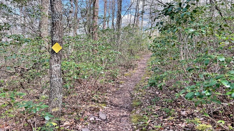
The trail terrain becomes more dirt and rocks. The grade also increases, but it’s very manageable. There’s not much to see, but it’s a nice section of trail.
The Falls Hollow Trail dead-ends at a gravel service road at the 3.0-mile mark. Consider a few more hiking stretches, then turn right for the final climb.
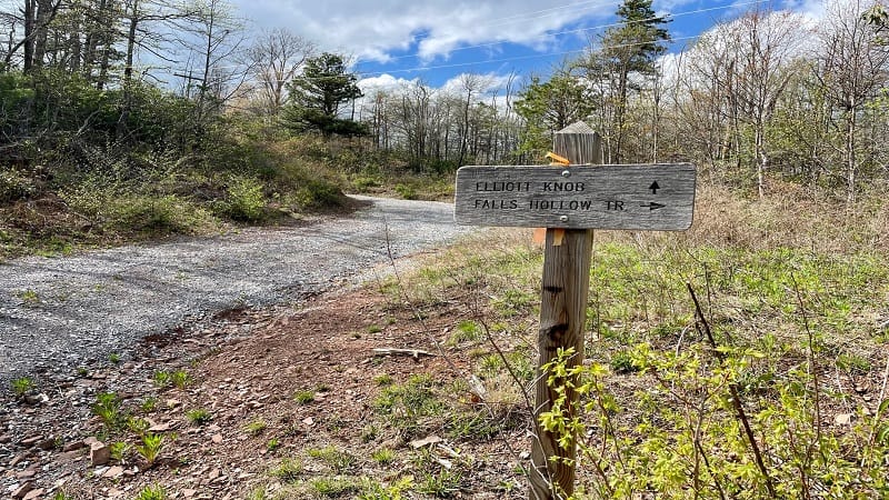
A Steep Climb
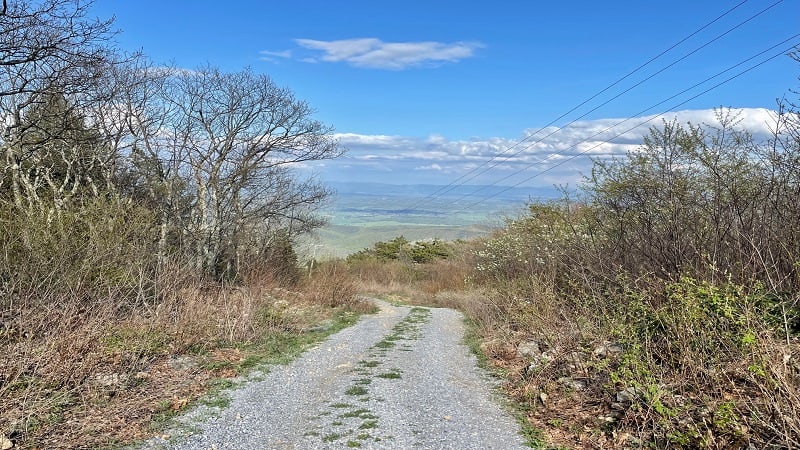
This gravel road leads to transmission towers for a local television and radio station. Honestly, I have no idea how even a four-wheel drive manages this road.
From here, it’s 1.5 miles to Elliott Knob. I stopped many, many times on the way up this service road. Stay hydrated on this climb. It’s a toughie.
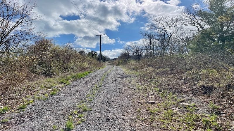
At the 4.1-mile mark, the gravel road flattens as you reach a small pond. You will also think you are close to the fire tower, but you still have 0.4 miles.
You’ll reach the North Mountain Trail at the 4.2-mile mark, but just keep trudging up the gravel road. You are getting close. I promise.

At the 4.4-mile mark, you’ll see a trail marker on the left, but it’s for the North Mountain and Cold Springs Trails.
There are also several shaded camp sites tucked away in this forested section. Walk past this trailhead and the trail narrows again for the final steps.
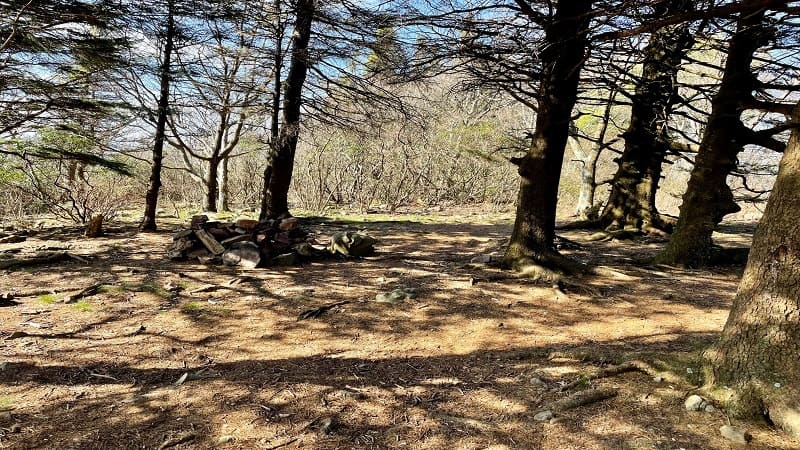
A few more feet up the trail is a small rocky overlook with west-facing views. Then, at the 4.6-mile mark, the fire tower comes into view. Thank goodness.
Elliott Knob
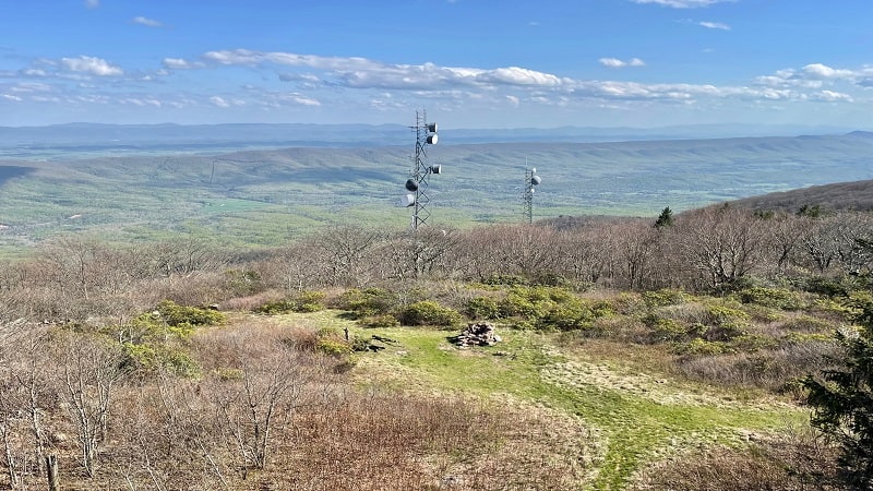
At the summit, there’s an open grassy area in front of the Elliott Knob fire tower with a large stone fire pit as a well as a few logs that serve as benches.
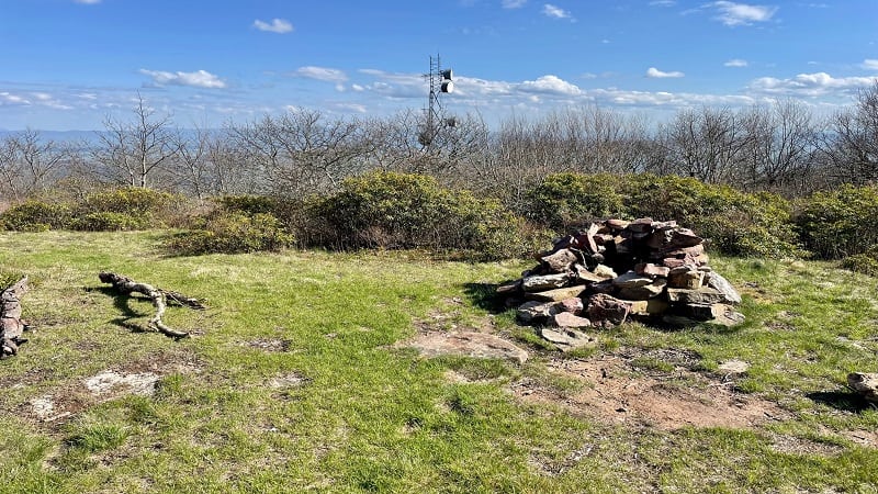
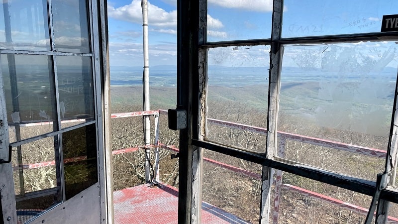
The fire tower is surrounded by a metal fence, but the gate is open. Hikers can climb the 40+ steps to the top of the lookout tower for 360-degree views.
A still-standing fire tower is a rarity, at least in Virginia, so enjoy the former lookout tower and the panoramas from one of Virginia’s highest peaks.
Just to the left of the tower, peek into the wooded area and you’ll find a few more shaded camp sites with stone fire rings.
Once you’ve savored all the views, re-trace your steps to the trailhead. Take care descending the gravel access road but enjoy the scenic vistas across the valley.
I hope you brought champagne because once you return to your car you’ll want to pop open a bottle to celebrate completing one of the hardest hikes in Virginia.
Wrap-Up Notes
From the parking area, the Elliott Knob hike near Buffalo Gap took me nearly four hours. This includes time spent stopping again and again on the final climb.
As you can imagine, given the large green space at the site of the tower, as well as the tucked away camp sites, this is a popular backpacking destination.
For a less challenging area hike, check out the loop hike at Natural Chimneys Park in Mount Solon. It’s one of my favorite hikes in the area.
This 1.9-mile hike is an easy loop that wows with geologically curious limestone formations, as well as cool caves and sinkholes to explore.
Hungry for more? Take a look at 15 of the best hikes near Staunton, Virginia to find a few more hikes to add to your must-do hiking list.

Erin Gifford has completed more than 300 hikes in Virginia. She is also the author of three hiking guidebooks from Falcon Guides. Need help finding a hike? Check out the Trail Finder feature or send Erin an email at [email protected].

