Machicomoco State Park: Get to Know Virginia’s 40th State Park
A few weeks ago, I set out to explore Virginia’s Northern Neck and Middle Peninsula. I was eager to see our newest state park, Machicomoco State Park.
Then, before I knew what happened, Clinch River State Park in St. Paul became our newest state park. Just like that, there are now 41 state parks in Virginia.

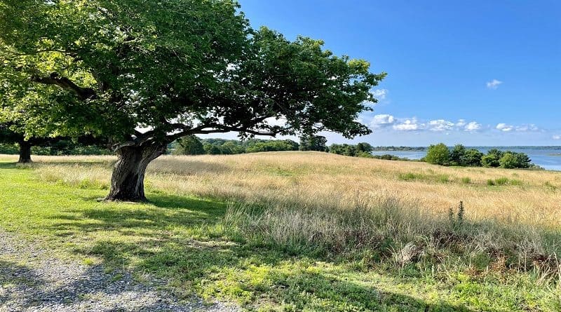
I was excited to be among the first to visit our newest state park. I always seem to be a step behind. Still, 645-acre Machicomoco State Park in Hayes is a delight.
Set on a peninsula on the York River, Machicomoco is a work in progress, but with a campground, three hiking trails and a boat launch, it’s coming along nicely.
Machicomoco State Park
Machicomoco State Park is 10 miles down the York River from Werowocomoco, a village that was once home to Chief Powhatan, a political and spiritual leader.
In fact, Werowocomoco generally translates from the Virginia Algonquian language as “place of leadership.” Chief Powhatan’s daughter, Pocahontas, lived there too.
It’s a certainty that the state park’s land was associated with Tsenacommacah, a name given by the Powhatan people to their native lands on the coast of Virginia.
A celebration of this Native American heritage can be seen across Machicomoco State Park, most notably on the .9-mile Interpretive Trail.
Hiking Trails
There are three hiking trails at this state park, including the Loop Trail (3.1 miles) and Forestry Trail (2.4 miles).

The Loop Trail is a paved walk around the park, while the Forestry Trail is a shaded walk in the woods. The Interpretive Trail is by far the best hiking trail at this time.
The Interpretive Trail begins at the parking area in the far southeast section of the park. Note that there is no signage for the trail, but there are red-blazed markers.

You’ll see a paved trail set off to the left of the restrooms. Stay right at the split. At the .1-mile mark, the trail veers to the right to connect with the Forestry Trail.
There is no signage (at least not yet). Stay left until the .2-mile mark. Here, you’ll spy a short wooden boardwalk on the right. Proceed to the fishing dock.

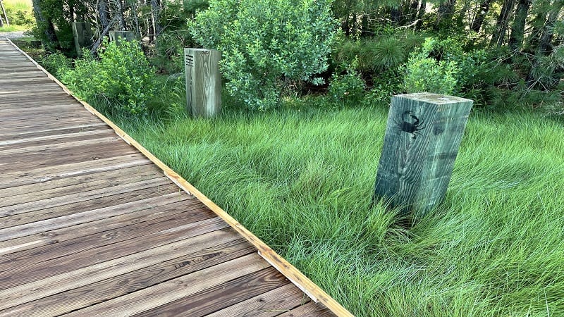
The views across the York River are fantastic. On the return, notice the wooden markers to the right of the dock. Each has a drawing of a native animal, like a crab.
Native American Heritage
On the dock you will see the Algonquian word for the drawing. In this case, “tuttascuc.” Or, crab. The English translation is written to the left of the word.
Re-trace your steps to the path, then turn right to ascend the small hill. In a few steps, you will see the remains of Timberneck House, which dates back to 1800.
But first, continue on to the right to the end of the peninsula. At the .4-mile mark, you’ll reach an interpretive stop, again showcasing the Algonquian language.
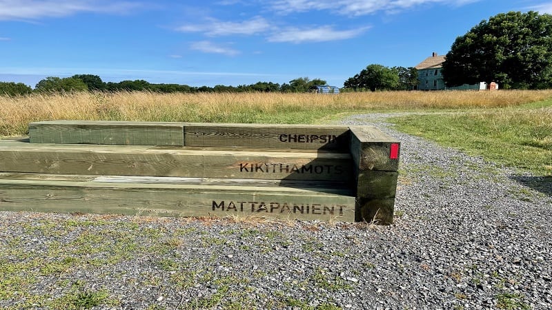
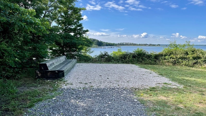
The gravel trail splits, but you can go either way since the two re-connect in a few more feet. At the peninsula, enjoy views across Timberneck Creek.
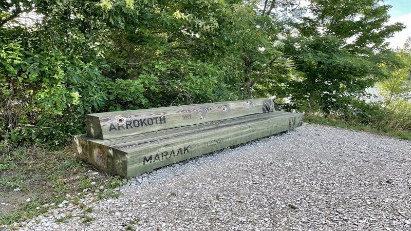
At the peninsula, the trail terrain changes to crushed oyster shells. A bench shares two more Algonquian words: arrokoth (sky) and maraak (cedar).
Re-trace your steps. At the .8-mile mark, stay right to be front and center at Timberneck House. There is an educational placard on the home’s preservation.
Timeline
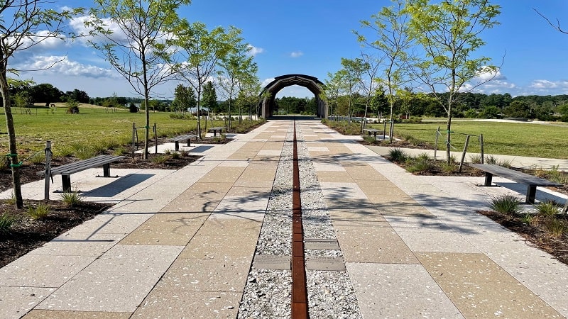
Your hike is complete at the .9-mile mark. Be sure to stop for the large open-air interpretive structure. A path to the structure features a timeline.

The timeline begins at 16,000 BC with the creation of channels that ultimately formed the Chesapeake Bay, the largest estuary in the United States.
Note the year Powhatan Indians met the English colonists (1607), as well as dates when Virginia formally recognized local Native American tribes (1983-2010).
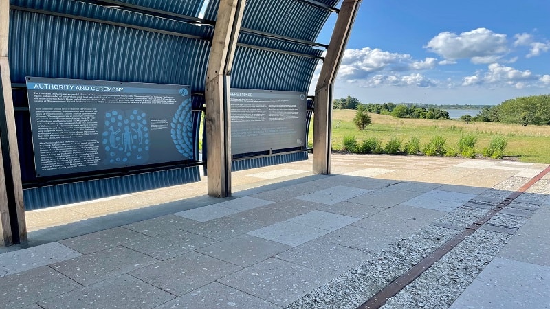
Inside the structure, placards educate on the landscape and the role of the various Native American communities in the region.
Campground
Machicomoco State Park has a campground with 27 camp sites. Of these, 13 sites have electric and water hook-ups for RVs and tents. They are also in full sun.

There are 14 tent-only sites. These are walk-in sites, but the walk is no more than 50 yards. These are mostly shaded and offer more privacy than other sites.
In addition to tent and RV sites, there are three brand-new yurts. None of the sites at the campground have river views, but they do have fire rings and picnic tables.
Wrap-Up Notes
With picnic shelters, car top boat launches, an interpretive area and a campground, Machicomoco State Park is a nice addition to Virginia State Parks.

The fee to enter this Gloucester County state park for hiking near Williamsburg is $5 per vehicle. There is no visitor center or camp store.
Machicomoco State Park is located at 3601 Timberneck Farm Road in Hayes. Apple Maps doesn’t recognize the park just yet, so the address is helpful to know.

Erin Gifford has completed more than 300 hikes in Virginia. She is also the author of three hiking guidebooks from Falcon Guides. Need help finding a hike? Check out the Trail Finder feature or send Erin an email at [email protected].

