A Scenic Hike to Big Cedar Creek Falls at Pinnacle Natural Area Preserve
As I snaked along two-lane roads northeast of Lebanon, Virginia, I was uncertain about my final destination.
At the final turn onto a narrow, gravelly State Park Road, I was even more unsure. I slowly drove the last mile. Then, an oasis.
I had reached Pinnacle Natural Area Preserve, an 891-acre natural preserve in Russell County. Managed by Virginia State Parks, I was bowled over by this stunningly beautiful preserve. A true hidden gem.
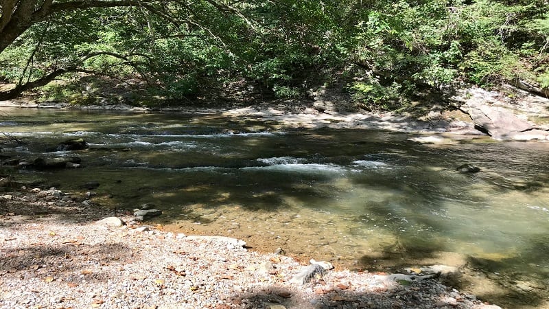
Situated at the junction of the Clinch River and Big Cedar Creek, Pinnacle Natural Area Preserve is best known for Big Cedar Creek Falls (also known as Big Falls).
I was eager to hike the Big Cedar Creek Trail to see Big Falls, but quickly learned there is much more to this nature preserve, like a cascading creek, a rushing river, a timeworn cemetery and a towering dolomite formation.
| Trail Stats | |
|---|---|
| Length | 3.1 miles |
| Difficulty | Easy |
| Trail Type | Out-and-Back |
| Elevation Gain | 272 feet |
| Duration | 2-2.5 hours |
| Terrain | Mostly grass, dirt & gravel trails |
| Dog-Friendly | Yes |
| Fee | Free |
| Driving Directions | Click Here |
Arriving at the Trailhead
On arrival, you’ll be pleased to note that the gravel parking lot is large. There is room for at least 15 or 20 cars. There is also a dedicated lot with accessible parking spaces.

A porta potty is close to the trailhead. There is also a large trail sign with the natural history, geological formations and public access facilities at the natural preserve.
Several picnic tables sit adjacent to Big Cedar Creek. The calmly flowing water is incredibly relaxing. It’s an ideal spot to skip stones, too.
The First Steps
This 3.1-mile out-and-back hike on blue-blazed trail in Southwest Virginia begins with a swinging bridge. This takes you up and over burbling Big Cedar Creek.

At the .1-mile mark, look to your right to see a shallow stream ford. This is essentially an underwater bridge. It looks more like a sidewalk overwhelmed with flowing waters.
As you continue downstream, the trail gets rocky, then the terrain becomes a mix of grass, gravel and dirt. A fairly basic hiking trail.

At the .4-mile mark, the Big Cedar Creek Trail intersects with the Grapevine Hill Trail on the left. Continue straight on the wide blue-blazed path alongside calming waters.
In another half-mile, you’ll see a second trail junction. This time, turn left to go uphill for the Big Cedar Creek Trail. There is a bench too if you’d like to take a quick break.

If you were to go straight, you’d reach a picnic shelter and a restroom. Unfortunately, the restroom was closed (likely due to coronavirus) when I was there in September 2020.
At the back of the picnic shelter, you’ll find the trailhead for the green-blazed Spring Falls Trail. This is an easy .5-mile round-trip hiking trail.

Okay, back to the Big Cedar Creek Trail. As you proceed up the trail, look right in 20 yards or so to see the overgrown Sykes Cemetery behind a split rail fence.
The headstones are for family members who once lived on the land when the natural area preserve was under private ownership many years ago.

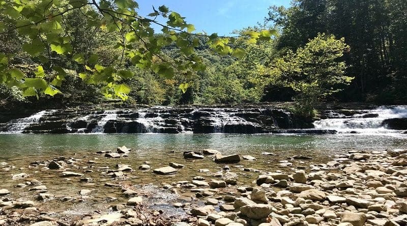
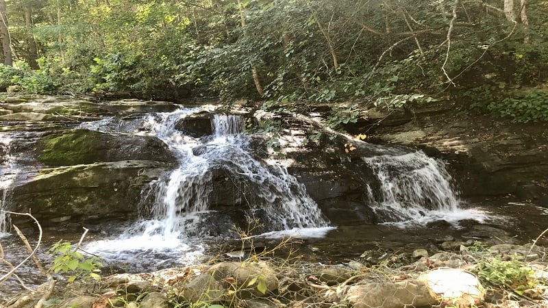
At the 1-mile mark, you’ll catch your first glimpse of waterfalls. These are actually flowing cascades that feed into Big Cedar Creek Falls.
In less than a quarter-mile, you’ll reach a short spur trail on the right that steps down to Big Falls.
For lovers of waterfall hikes in Virginia, this is a three-fer (even better than a two-fer) since there are three different styles of waterfalls.
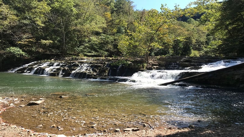
There is a stone-covered beach area that is just right for a picnic. Spend as much time here as you like. Big Falls is incredibly beautiful.
From here, re-trace your steps on the spur trail, then turn right to continue on the Big Cedar Creek Trail.
At the 1.5-mile mark, you’ll ascend a few stairs, then reach a four-way trail junction. Continue straight for the blue-blazed trail.
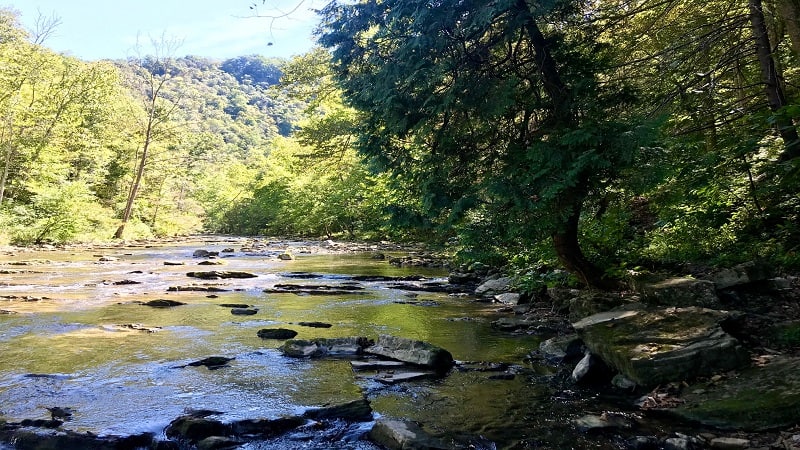
You will reach the water’s edge of the Clinch River near the 1.6-mile mark. This is a great spot for tossing in stones or to cop a squat on a rock to re-fuel or re-hydrate.
Since this is an out-and-back hike, simply re-trace your steps to the parking area.
If you’re eager for more steps, there are two short side hikes. As you hike uphill from the river, pause at the four-way intersection.

Your first option is to turn left onto the orange-blazed Pinnacle View Trail. This is a .3-mile out-and-back hike to see the park’s namesake, The Pinnacle.
You’ll first reach a trail sign with a background on The Pinnacle, a massive geological formation made of dolomite and sandstone that towers 600 feet over Big Cedar Creek.

In a few more steps, you’ll see a wooden bench facing the Clinch River. Take a seat and look way up high to see The Pinnacle. From here, re-trace your steps to the four-way trail junction.
If you keep walking past the bench, the orange-blazed trail continues on, intersecting the blue-blazed Big Cedar Creek Trail, but much closer to the river.
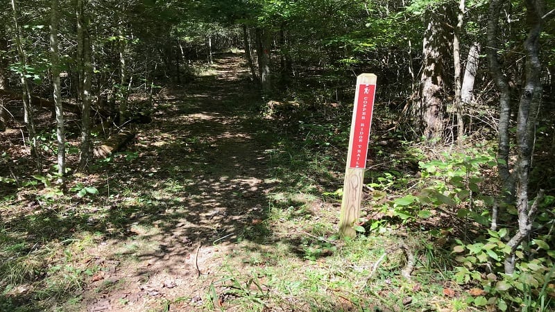
Okay, back at the four-way intersection, the second option is to continue straight onto the red-blazed Copper Ridge Trail.
This is a fairly steep uphill slog (I know, I’m really selling this option) to a wooden overlook platform for northwest-facing views of the mountains and valleys.

The views are quite nice, but somewhat limited due to leafy foliage. You may be able to enjoy more wide-reaching views once the leaves have fallen. This side hike is .8-mile round-trip.
From here, re-trace your steps to the four-way junction, then turn right to hike 1.5 miles to the parking area.
Hike Options
For fewer steps, it’s a snap to hike out to Big Falls, then return to the parking area. This will make for a 2.4-mile out-and-back hike.
For more steps, add on one or more of the following trails in the nature preserve: Copper Ridge Trail (.8-mile), Pinnacle View Trail (.3-mile) or Spring Falls Trail (.5-mile).
Wrap-Up Notes
From the parking area, this hike took me nearly 90 minutes, including time spent ogling the waterfalls.
For a post-hike bite, backtrack to the town of Lebanon (less than six miles), which has several sit-down restaurants, as well as fast food options, including Wendy’s, McDonald’s and Taco Bell.

Erin Gifford has completed more than 300 hikes in Virginia. She is also the author of three hiking guidebooks from Falcon Guides. Need help finding a hike? Check out the Trail Finder feature or send Erin an email at [email protected].

